Segnavia
Offline 3D hiking app for Veneto, Trentino, and South Tyrol: 5-metre LiDAR terrain, CAI trails, 1,602 routes, and turn-by-turn GPS guidance with no cell signal.
- Year
- 2026
- Technologies
- TypeScript, MapLibre GL, Capacitor, Python, Vite, IndexedDB
- Links
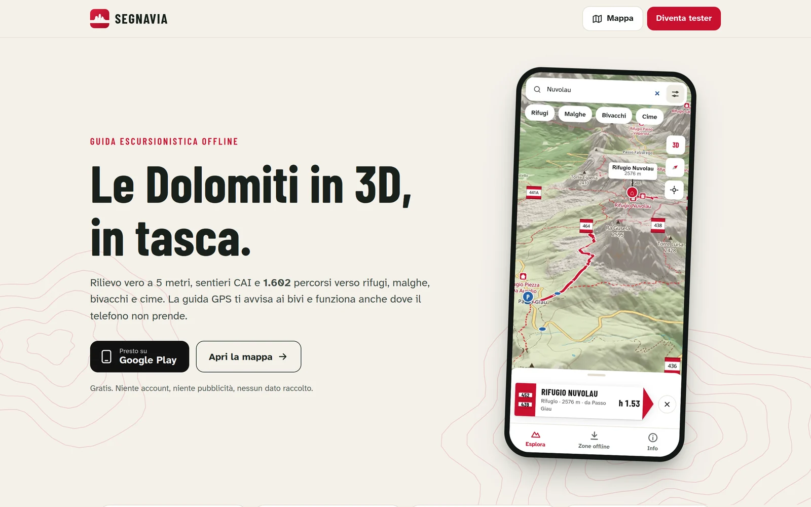
Cell service rarely holds up in the mountains, and generic maps flatten the terrain right where slopes, trail junctions, and turnaround times matter most. Segnavia is a hiking guide built to run completely offline across Veneto, Trentino, and South Tyrol, with no accounts, no ads, and no tracking.
Open data and offline packs
- Geospatial pipeline: a Python and Node pipeline turns open elevation and trail data (Veneto regional LiDAR, national 5 m HR-DTM, Copernicus DEM, and OpenStreetMap CAI trails) into downloadable regional base maps and area packs.
- 1,602 precomputed routes: trails to mountain huts, pastures, bivouacs, and summits calculated from the nearest trailhead along numbered paths, with ascent/descent hiking times derived from the actual elevation profile and CAI difficulty grades.
- Offline 3D map: powered by MapLibre GL JS serving local tiles from IndexedDB with a custom topographic style; multiple downloaded regions merge into one continuous map.
Field guidance
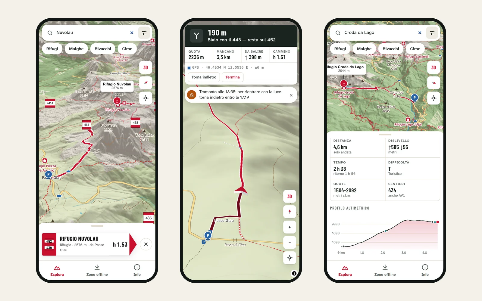
- Junction and off-trail alerts: warns ahead of each fork with the exact trail number to follow, alerts when drifting off route, and computes the latest turnaround time to get back before sunset.
- Lock-screen guidance and battery control: wrapped with Capacitor and a custom Android foreground plugin so guidance stays live on the lock screen and notification shade, with capped rendering frame rates to preserve battery.
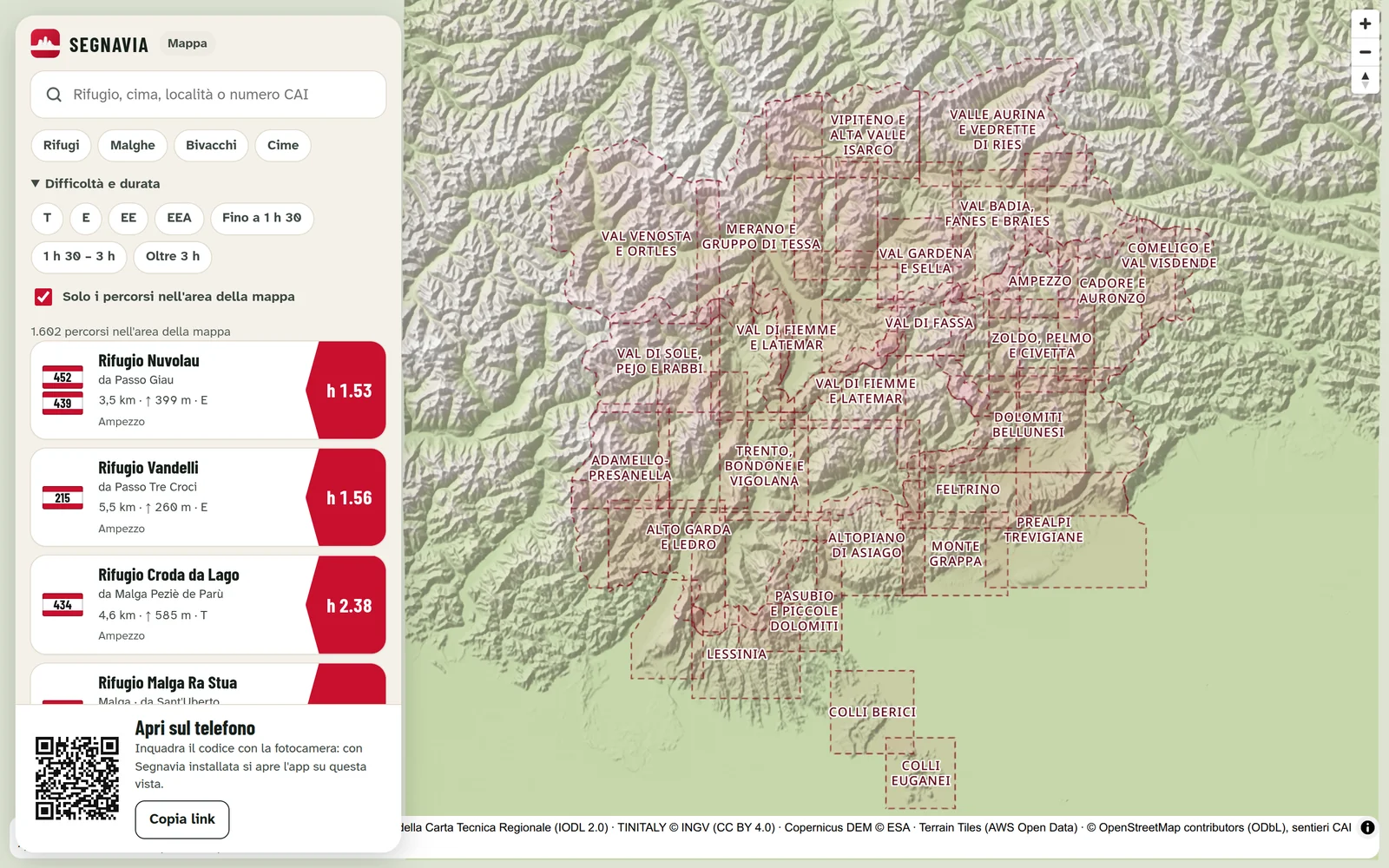
- Web companion map: segnavia.org lets hikers browse routes in the browser and hand off any trail directly to the mobile app via deep link or QR code.